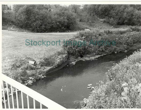
New Portwood Footbridge
The view from the new Portwood footbridge (1981/2) looking across the River Tame towards Heaton Norris. Showing the approximate location of an ancient ford indicated on the 1696 Dukinfield estate map of Brinnington/Portwood. The culvert outlet is in the shrubs on the water's-edge, and beyond, the rocky outcrop on the bank marks the stream originally forming the Cheshire/Lancashire boundary, enclosing Mill Wheat(?) field to Cheshire on the Lancashire bank of the Tame. (See 1851 5ft OS map).
- Image ID
- 45607
- Class number
- S/25 C56 More like this
- Photographer
- A. Phillips
- Date of image
- :1981/82
- Area
- Portwood
- In copyright?
- No
- Available to buy?
- Yes
Return to search results