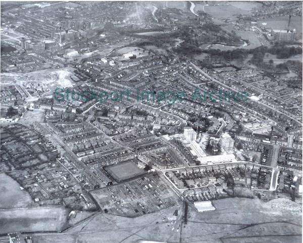
An Aerial View of the Hall Street/Turncroft Lane Area
An aerial view of the Hall Street/Turncroft Lane area. Hall Street crosses the middle of the picture from left to right, and the tower blocks of Victoria Park are in the lower right, the mills and factories of Portwood are top left.
- Image ID
- 5024
- Class number
- S/A 67 More like this
- Photographer
- Aerofilms & Aero Pictorial Ltd.
- Date of image
- 1963:21/10/1963
- Area
- Offerton
- In copyright?
- Yes
Return to search results