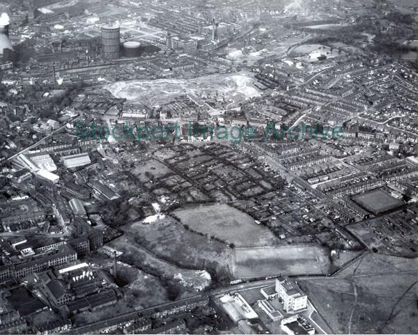
An Aerial View of the Hall Street Area of Stockport
An aerial view of Hall Street and beyond, looking north east. Edgeley telephone exchange, Ward Street football ground, part of Christies Hat Works, Canal Street, Hawfield Gardens and houses in Welsh Lane are in the lower part of the photograph. Churchgate/Hall Street runs across left to right just above centre, leaving a view of the Turncroft Lane area and Portwood, right and left respectively in the upper section.
- Image ID
- 5076
- Class number
- S/A 67 More like this
- Photographer
- Aerofilms & Aero Pictorial Ltd.
- Date of image
- :circa 1963
- Area
- Offerton
- In copyright?
- Yes
Return to search results